
Allen Park Postal Coverage
The verified standard ZIP associated with Allen Park is 48101. USPS evidence comes from the Allen Park Post Office listing, and the research did not establish another standard ZIP for the city. That is a carefully limited finding. A complete City and State USPS response was not captured during research, so a new search should be saved before claiming citywide postal completeness. Nearby ZIPs provide boundary context, not additional Allen Park coverage.
| ZIP | Area evidence | Post-office evidence | Records note |
|---|---|---|---|
| 48101 | Standard ZIP associated with Allen Park | Allen Park Post Office listing | Validate the exact street address before using it as a search filter. |
| 48101-9998 | Post-office facility ZIP+4 | 6800 Roosevelt Avenue facility address | It is not a second standard Allen Park ZIP. |
| 48146 | Nearby Lincoln Park context | Regional postal geography | Do not treat it as Allen Park coverage without address validation. |
| 48122 | Nearby Melvindale context | Regional postal geography | Postal labels and municipal lines can differ. |
The Allen Park Post Office listing is the official local evidence for 48101 and the facility suffix.
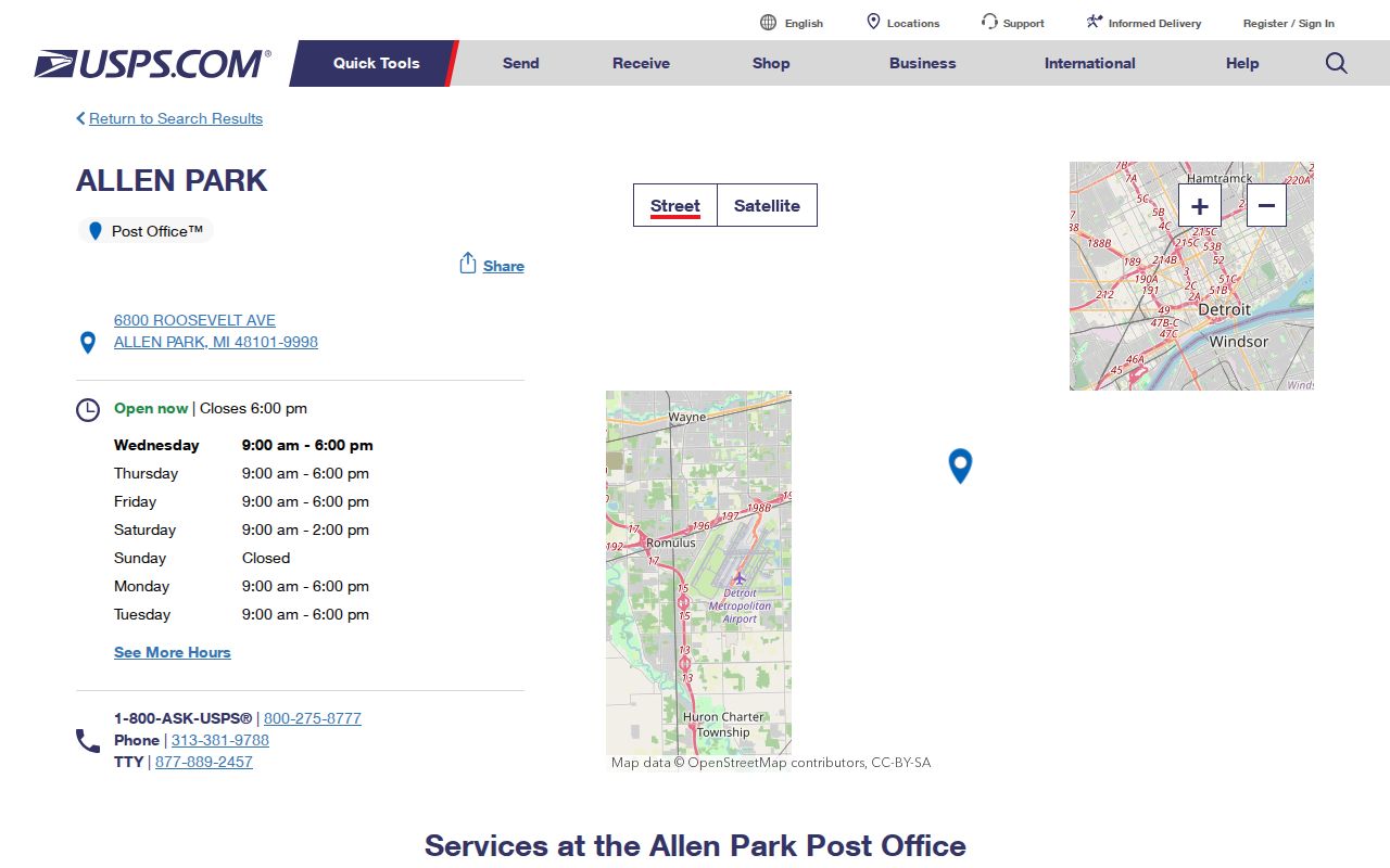
The facility address confirms a postal association, while the suffix identifies the post office rather than a separate residential ZIP.
Allen Park Postal Checks
Use the official USPS ZIP Code Lookup before a ZIP-based records search. It provides three verified modes: a full address search, a City and State search, and Cities by ZIP. USPS standardizes the mailing address returned by its system. It does not confirm that a person or company is at that address. That distinction matters when a record includes an older address, a mailing address, or a regional directory label.
| USPS mode | Verified fields | Best use |
|---|---|---|
| By Address | Company, street, apartment or suite, city, state, ZIP | Standardize a complete address before comparing it to a parcel. |
| By City and State | City and state | Check the current postal response for Allen Park, Michigan. |
| Cities by ZIP | ZIP | See the postal city naming associated with a ZIP. |
The street address and city are required in the address mode, while company and apartment fields are optional. Save the exact response with the search date. A postal result is strongest as a mailing validation step, not as evidence of a city-limit location.
Allen Park ZIP Boundary Layers
ZIP, Census ZCTA, city boundary, and parcel boundary are different layers. The Wayne County GIS data page provides postal-area, parcel, municipal-boundary, road, park, and school-district layers. Its data caveats still apply, and the county states that local municipalities maintain current assessment maps. The city street system and zoning maps add local shape, but they do not replace an individual parcel record.
The county’s GIS layers are useful for explaining why a postal result and a city label appear to disagree. Select the appropriate municipal-boundary and ZIP layers, then verify the address with the Allen Park assessor or a county parcel route. A map point is not a survey, and a ZIP layer should not be treated as legal boundary evidence.
The county GIS data source identifies the layers available for that comparison.
Using a named GIS layer makes the reasoning visible when postal, municipal, and parcel geography do not line up.
Allen Park ZIP and ZCTA
The Census Bureau’s ZCTA guidance explains that a ZCTA is a statistical approximation, not a USPS delivery ZIP. ZCTAs can be noncontiguous and can include unique or institutional delivery patterns. Use a ZCTA for statistical geography only after labeling it as a Census product. Use USPS for the operational postal answer, and use the assessor or parcel viewer for the city property question.
The 2020 Census count for Allen Park was 28,638, while the July 2025 QuickFacts estimate was 27,445. Those figures describe population totals, not a directory and not a count of postal delivery addresses. They help show why a postal directory should be a geographic reference rather than a resident roster.
The Census explanation of ZCTAs supplies the statistical boundary distinction.
The Census image supports the geographic definition, while USPS remains the source for address-level mailing validation.
Find Allen Park Records by ZIP
A ZIP is a starting filter, not a direct person-search field in every official system. The research did not confirm an Allen Park assessor ZIP filter or live parcel-viewer ZIP search control, so neither should be promised. The reliable sequence is to validate the mailing address, use the GIS ZIP layer for map context, and then search the record system by its verified fields. Allen Park BS&A accepts address, owner, and parcel number. The county deed search and court index use their own identifiers.
- Run the complete address through USPS and retain the standardized city, state, and ZIP response.
- Compare the address with the Wayne ZIP and municipal-boundary layers without treating either as a parcel survey.
- Use Allen Park BS&A by address, owner name, or parcel number to locate the relevant parcel record.
- Move to the county deed index or another custodian only with a name, parcel, instrument, or court reference that its system accepts.
Once a ZIP has narrowed the area to a particular road, the Allen Park street directory gives the address-based research path. Note: A ZIP label narrows mailing geography, but an address and parcel are needed for a dependable local record match.
Allen Park Parcel Route by ZIP
The Allen Park assessor and Wayne County GIS form the practical bridge from a postal clue to a parcel. The assessor’s documented fields are address, name, and parcel number. Its instructions say to omit common street suffixes, use the number range fields for an address, and repeat a single house number in both range boxes. Allen Park parcel numbers begin with 30 according to the city instruction PDF.
After selecting the parcel number, the instructions describe General, Buildings, Sales, and Images/Sketches tabs. Compare a sales entry to the Register of Deeds if a recorded instrument matters. The instructions include a no-accuracy-guarantee notice, so the city office and recorder remain the verification paths. A postal code can help locate the right mailing area, but it does not replace the parcel identifier.
- Parcel
- A land-record identifier used by the assessor and related property systems.
- Situs address
- The physical location used to identify a parcel, which can differ from a mailing address.
- Legal description
- The formal land description in a recorded instrument, separate from the common street address.
Allen Park Postal Record Roles
Four official systems answer different questions after a postal area narrows a location. Allen Park Assessing provides the current municipal parcel summary. The Wayne County Parcel Viewer supplies map context and downloadable layers. The Wayne Treasurer’s delinquent-tax portal accepts a municipality, street number and street name, or a parcel ID. The Register of Deeds holds recorded instruments. None of those systems uses a postal code as proof of ownership, city residency, or title. The more precise the question, the more important it is to move from the ZIP to the address, parcel, or recorded-instrument reference.
| Question after a postal check | Best official route |
|---|---|
| Which parcel matches the street address? | Allen Park Assessing and the Wayne County GIS parcel context. |
| Is delinquent tax information listed? | Wayne County Treasurer property-tax search by address or parcel ID. |
| Which instrument transferred an interest? | Wayne County Register of Deeds, using an index lead and the proper copy path. |
| Does the mailing address standardize? | USPS ZIP lookup, followed by a municipal and parcel comparison. |
This separation prevents an old postal label from being asked to answer a legal-description or present-tax question. For a longer address trail after the parcel is identified, use the street-based route rather than trying to expand a ZIP result into a block list.
Allen Park ZIP Facility Suffix
The post-office listing gives a useful local caution: 48101-9998 belongs to the facility address at 6800 Roosevelt Avenue. It is ZIP+4 evidence for that location, not a newly discovered second standard ZIP for Allen Park. ZIP+4 refines an address for delivery. It should not be copied into an unrelated address or used to infer a resident’s location.
- ZIP
- The USPS delivery code associated with a mailing address or postal area.
- ZIP+4
- An added four-digit suffix that refines delivery for a specific address or delivery segment.
- PO-box ZIP
- A ZIP used for a post-office box route, which may not describe nearby street delivery.
- Carrier route
- A delivery sequence used by USPS that is different from a municipal boundary or parcel line.
Call or consult the official postal listing for current retail hours and facility details, as operational schedules can change.
Allen Park Postal History Labels
An old directory, census, deed, or newspaper can use a postal or regional label that does not match today’s incorporated-city wording. Allen Park’s area was part of Ecorse Township before the village was established in 1927 and the city incorporated in 1957. Preserve the original label in a historical citation, then compare the street map, zoning map, assessor legal description, and GIS boundary layer to establish the modern jurisdiction.
Nearby ZIPs such as Lincoln Park, Melvindale, Dearborn, Southgate, Taylor, Wyandotte, and Riverview are context for a regional result, not proof of an Allen Park location. That same care applies to a Downriver directory heading. The title, date, and source decide what the city label means.
Allen Park Postal Directory Limits
A postal search returns an address standardization result, not a current-residence confirmation. USPS, Census ZCTA, county GIS, city boundaries, and parcel records answer different questions. County GIS controls were not fully exposed during the research inspection, including exact address, parcel-ID, buffer, and export behavior. Use the official viewer without assuming those functions are available.
For an apparent address or boundary error, contact the issuing source. The Allen Park assessor handles local parcel questions, Wayne County maintains the recorder and GIS routes, and USPS handles operational mailing-address validation.